MULLAYANAGIRI TREKKING
Mullayanagiri, Karnataka, India

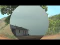
Mullayanagiri peak is located in the Baba Budan Giri Range of Western Ghats. It serves as the highest peak between the Nilgiris and the Himalayas offering its visitors a relaxed environment with temperature ranging between 20-25 degrees Celsius. Known for its peaceful ambience and nature's raw beauty, this peak is adorned with verdant grassland, rugged rocks, and a good trek path is also quite popular among adventure lovers. Mullayanagiri is also known for coffee plantations that are situated nearby. Mullayanagiri is best known as a hub for adventure enthusiasts, especially trekkers as this destination is adorned with perfect trek trail.
Interesting Facts
- There’s a small temple located on the topmost summit of this Mullayanagiri peak within which you have a small statue of Tapasvi Mullappa Swamy.
Suggested time duration
5 HoursCrowded Period
WeekendBest Season To Visit
September to February


Do's & Dont's
- Avoid uncomfortable clothing during the activities (like sarees).
- Carrying jewellery or other valuables is not advisable.
- No smoking or consumption of alcohol before or during the activity.
- Kindly dispose of plastics in an appropriate manner.
Architecture
Curabitur tempus quam id neque placerat ultricies. Duis ligula elit, faucibus ac diam nec, tristique scelerisque metus. Donec condimentum nunc nec suscipit blandit. Vivamus nulla nunc, sodales non risus sed, vehicula commodo velit. Praesent quis ipsum sed massa commodo gravida et sit amet quam. Curabitur tempus quam id neque placerat ultricies. Duis ligula elit, faucibus ac diam nec, tristique scelerisque metus. Donec condimentum nunc nec suscipit blandit. Vivamus nulla nunc, sodales non risus sed, vehicula commodo velit. Praesent quis ipsum sed massa commodo gravida et sit amet quam. Curabitur tempus quam id neque placerat ultricies. Duis ligula elit, faucibus ac diam nec, tristique scelerisque metus. Donec condimentum nunc nec suscipit blandit. Vivamus nulla nunc, sodales non risus sed, vehicula commodo velit. Praesent quis ipsum sed massa commodo gravida et sit amet quam.Timings
| Day | Start Time | End Time | Adult Entry Fee | Child Entry Fee |
|---|---|---|---|---|
| All Days | 05:00 AM | 05:00 PM | Free | Free |
Transport Connections
| Name | Distance | Contact Number |
|---|---|---|
| |
15.4 KM | 9449596666 |
|
|
18.3 KM | 139 |
| |
256 KM | 1800-425-4425 |
What to Carry
- **Sturdy and waterproof backpack (It will be advised that you pack light) **Water bottles **Sunscreen and sunglasses **Cap, Hat, Torch, Raincoat **Mosquito repellent cream
Suitable For
Parking
Parking is available for 10 Cars.Route Alert
The road is narrow so be little careful.Nearest Town
| Town Name | Distance |
|---|---|
| Chikmagalur | 23 KM |
Nearest Temples
 SRI KODANDARAMA TEMPLE
This temple was built in 13th century by Hoysala Empires
SRI CHENNAKESHAVA SWAMY TEMPLE
An architecture temple marvel that was built in the early 12th century by the Hoysala rulers
HOYSALESHWARA TEMPLE
The temple is a Dvikuta dedicated to Hoysaleshwara and Shantaleshwara
SRI VEERA NARAYANA TEMPLE
Temple is famous for it's Trikuta Architecture
SRI MARKHANDAYA TEMPLE
This temple was built by Hoysala Empires
SRI AMRUTHESHWARA TEMPLE
The temple was been built in 1196 CE
Nearest Attractions
 Hill StationCHIKMAGALUR HILL STATION
Located at a height of 1900 meters
 CavesMULLAYANAGIRI CAVE
This is the highest peak with an altitude of 1950 meters
 WaterfallsHEBBE FALLS
Waterfalls gushes down from a height of 551 ft in two stages
 FortMANJARABAD FORT
Situated at an altitude of 3, 240 feet
 DamBHADRA DAM
Intended towards increasing rice cultivation
 WildlifeBHADRA WLS
Mix of southern and Northern tropical dry deciduous forest
 MuseumSHIVAPPA NAYAKA PALACE MUSEUM
Named after the popular king Shivappa Nayaka of Keladi Nayaka dynasty
User Reviews
Map